How to Read a Topographic Map Before Excavating
Before starting any excavation project, understanding the lay of the land is crucial. A topographic map provides detailed information about elevation, slope, and terrain features that can affect how and where you dig. Whether you’re building a road, pad, or trench on rural Montana land, knowing how to read a topo map helps you plan smarter and avoid surprises.
What Is a Topographic Map?
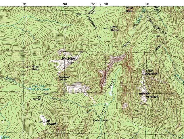
A topographic map shows the shape and elevation of the land using contour lines. Each line represents a specific elevation above sea level, and the spacing between lines tells you how steep or flat the terrain is. These maps often include other features like creeks, roads, and property boundaries.
Key Elements to Understand
- Contour Lines: Each line connects points of equal elevation. When the lines are close together, the slope is steep. When they’re far apart, the land is relatively flat.
- Index Lines: These are thicker contour lines labeled with elevation numbers (such as 4200 feet) to help you understand the relative height of the land.
- Scale: The scale tells you how map distance relates to real-world distance. A 1:24,000 scale means 1 inch on the map equals 2,000 feet on the ground.
- North Arrow: Indicates the orientation of the map so you can align it with your property.
Why It Matters for Excavation
Reading a topo map can help you:
- Find high and low points to plan drainage
- Identify slopes that may require terracing or retaining walls
- Estimate cut and fill volumes for grading and road work
- Plan the most efficient route for access roads and utility trenches
Practical Example
If contour lines drop from 4400 to 4300 feet across 100 horizontal feet, that’s a 10 percent slope, too steep for most standard driveways. With that info, you might reroute the drive to a more gradual slope or plan for switchbacks.
Montana-Specific Terrain Notes
- The western side of the state features rugged terrain and elevation changes that require careful reading
- The eastern plains may appear flat, but subtle contours can impact water drainage and pooling
- Topo maps are especially useful when planning near floodplains, ridges, or steep coulees
Tools and Resources
- USGS Topo Maps: Available online for free download or purchase
- GPS Apps: Tools like OnX, Gaia GPS, or Caltopo offer digital topo overlays
- Drone Surveys: Local excavation crews may offer aerial topo scans for custom mapping
Conclusion
A topographic map is one of the best tools you can use when planning excavation in rural Montana. It helps you work with the land instead of against it, ensuring that your project is safe, efficient, and built to last. If you’re unsure how to read your map, your contractor can help interpret it during a site walk.